Next stop: Brick's Brook. Much of the sediment deposited atop the calcareous bedrock is lacustrine in origin (from a lake), deposited 11,000 years ago when the glaciers were retreating - melting - but still blocking drainage of the fresh water to the north through the St Lawrence seaway. Water pooled up in the Champlain Valley, the only outlet being the Hudson River valley to the south. The drainage point here is about 600', so Lake Champlain, which was known as Glacial Lake Vermont, was about 500' above where it is today.
 |
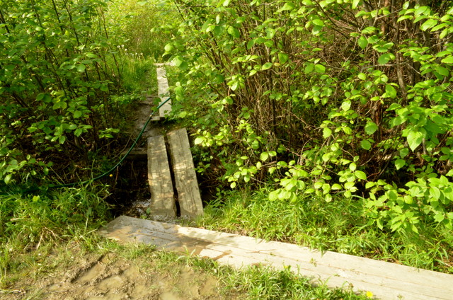
| The wet meadow, this is the "headwaters" of Brick's Brook |
 |
| At the edge of the meadow, it starts to cut into the soils |
 |
About 25 down from previous photo, excessive erosion exposing roots of white pine
(which once upon a time was a fence line as witnessed by the barbed wire embedded in it) |
The melt water draining off the mountains into the lake via the Winooski, Mississquoi, Lamoille, etc. would have been a muddy mess with glacial sediments. So Rock Point, which is adjacent to the lake, would have been a deep water environment, buried in alternating layers of silts and clays each year when the lake froze over. These silts and clays drain very poorly, accounting for the wet meadows and depressions found scattered over the land.
 |
| Further still downstream. Slopes of banks still steep. |
Once the glaciers retreated far enough to the north, finally opening up the St Lawrence seaway, water exploded out of the Champlain Valley, draining in a matter of hours or days down to an elevation of 300'. At that point, because the glaciers were so heavy, their weight had actually depressed the entire northern part of the continent - much like a large putting all your passengers at the stern of a flexible boat - by about 300' in this area. The glacial lake gradually grew saltier and saltier as water from the ocean filtered into Champlain Valley. The rivers continued flowing into the body of water; the Winooski River delta's edge terminated at Rock Point, depositing patchy layers of sand atop the lacustrine silts and clays.
 |
| Soil map generated by Web Soil Survey: http://websoilsurvey.sc.egov.usda.gov/App/WebSoilSurvey.aspx |
This sandier stuff erodes rather easily. Brick's Brook, which is only about 600m in length, starts as a trickle in the Old Pasture. A small bridge passes over the small notch carved into the clay soils. At the edge of the meadow, soils are much sandier and within 50m, the notch is a deep valley with steep slopes. Eventually the stream eroded down below the sandier soils, exposing silts and clays. Because these smaller soil particles are more difficult to erode, the valley widens rather than cutting further down. Towards the lower end of the stream the slope of stream is much gentler, water does not drain as well, and the course of the stream begins to meander, with water pooling up much more. In this section there are often green frogs and wood frogs.
 |
| Near the bottom, mellow grade to the brook and shallow slope to the banks due to erosion over time |
 |
High water table wreaking havoc on the hemlcoks and yellow birches
|
Species list is not complete (there are 5 different plants I need flowers to key out):
| Maple, red | Acer rubrum | | Aceraceae (Maple) |
| Maple, sugar | Acer saccharum | | Aceraceae (Maple) |
| Ivy, poison | Toxicodendron radicans | | Anacardiaceae (Cashew) |
| Birch, yellow | Betula allegheniensis | | Betulaceae (Birch) |
| Viburnum, maple-leaf | Viburnum acerifolium | | Caprifoliaceae (Honeysuckle) |
| Honeysuckle, ?? | Lonicera ?? | * | Caprifoliaceae (Honeysuckle) |
| Bittersweet, oriental | Celastrus ???? | * | Celastraceae (Bittersweet) |
| Dogwood, red-osier | Cornus sericea | | Cornaceae (Dogwood) |
| Witch-hazel, American | Hamamelis virginiana | | Hamamelidaceae (Witch-hazel) |
| Basswood, American | Tilia americana | | Malvaceae (Mallow) |
| Ash, green | Fraxinus pennsylvanica | | Oleaceae (Olive) |
| Hemlock, Eastern | Tsuga canadensis | | Pinaceae (Pine) |
| Buckthorn, common | Rhamnus cathartica | * | Rhamnaceae (Buckthorn) |
| Buckthorn, glossy | Frangula alnifolia | * | Rhamnaceae (Buckthorn) |
| Blackberry, common | Rubus allegheniensis | | Rosaceae (Rose) |
| Cherry, black | Prunus serotina | | Rosaceae (Rose) |
| Raspberry, black | Rubus occidentalis | | Rosaceae (Rose) |
| Rose, multi-flora | Rosa multiflora | * | Rosaceae (Rose) |
| Thimbleberry | Rubus odoratus | | Rosaceae (Rose) |
| Aspen, quaking | Populus tremuloides | | Salicaceae (Willow) |
| GRAPE sp. | | | Vitaceae (Grape) |
| Virginia creeper | Parthenocissus quinquefolia | | Vitaceae (Grape) |
| Jack-in-the-pulpit | Arisaema sp. | | Araceae (Arum) |
| Jewelweed, spotted | Impatiens capensis | | Balsaminaceae (Touch-me-not) |
| Solomon's seal, false | Smilacina racemosa | | Liliaceae (Lily) |
| Crowfoot, small flower | Ranunculus abortivus | | Ranunculaceae (Buttercup) |
| Lily, trout | Erythronium americanum | | Liliaceae (Lily) |
| Skunk cabbage | Symplocarpus foetidus | | Araceae (Arum) |
| Dandelion | Taraxacum officinalis | * | Asteraceae (Aster) |
| Meadow rue, early | Thalictrum dioicum | | Ranunculaceae (Buttercup) |
| Baneberry, red | Actaea rubra | | Ranunculaceae (Buttercup) |
| Nightshade, enchanters | Circaea sp | | Onagraceae (Evening primrose) |
| Miterwort | Mitella diphylla | | Saxifragaceae (Saxifrage) |
| Nettle, wood | Laportea canadensis | | Urticaceae (Nettles) |
| Nightshade, deadly | Solanum dulcamara | * | Solanaceae |
| Speedwell | Veronica sp | | Scrophulariaceae (Figwort) |
| Fern, lady | Athyrium filix-femina | | Athyriaceae |
| Fern, bracken | Pteridium aquilinum | | Dennstaedtiaceae (Bracken) |
| Wood fern, spinulose | Dryopteris carthusiana | | Dryopteridaceae (Wood fern) |
| Wood fern, intermediate | Dryopteris intermedia | | Dryopteridaceae (Wood fern) |
| Horsetail, wood | Equisetum sylvaticum | | Equisetaceae (Horsetail) |
| Horsetail, meadow | Equisetum pratense | | Equisetaceae (Horsetail) |
| Fern, sensitive | Onoclea sensibilis | | Onocleaceae (Sensitive Fern) |
| Fern, ostrich | Matteuccia struthiopteris | | Onocleaceae (Sensitive Fern) |
| Fern, cinnamon | Osmunda cinnamomea | | Osmundaceae (Royal fern) |
| Fern, interrupted | Osmunda interrupta | | Osmundaceae (Royal fern) |
| Fern, maiden hair | Adiantum pedatum | | Pteridaceae (Maidenhair) |
| Fern, New York | Thelypteris noveboracensis | | Thelypteridaceae (Marsh) |


No comments:
Post a Comment